Mineral Tenements · Northern Territory

Our Projects

Exploration Licence EL27811

Gold & Copper

Winnecke Goldfield

16.2t
Indicated Gold Deposit
11.45 g/t
Average Gold Grade (Au)
95 km²
Tenement Area
16 km
Gold Vein Strike Length

Location & Setting

AMI's Exploration Licence EL27811 is located approximately 65 km northeast of Alice Springs, extending about 60 km east-to-west. Its western end is only 35 km from the Stuart Highway and the Adelaide–Alice Springs–Darwin railway, providing excellent infrastructure access.

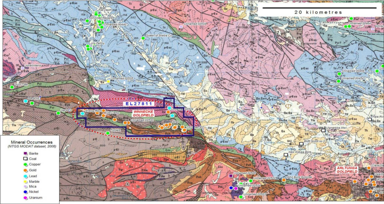
The tenement covers 95 km² and encompasses two historically significant goldfields: the Winnecke Goldfield and the Arltunga Goldfield. Main resources include gold, copper, and associated base metals.

Geological Settings & Mineralisation

Regional and local geological settings determine high levels of gold and copper mineralisation. Gold and copper mineralisation is widespread throughout the area, concentrated in a 16 km long quartz vein along major geological faults.

The gold-dominant mineralisation is commonly associated with copper mineralisation in the ESE-WNW Arltunga-Winnecke gold belt. The main gold-bearing areas are the Winnecke and Arltunga goldfields.

Gold Mineralisation Types

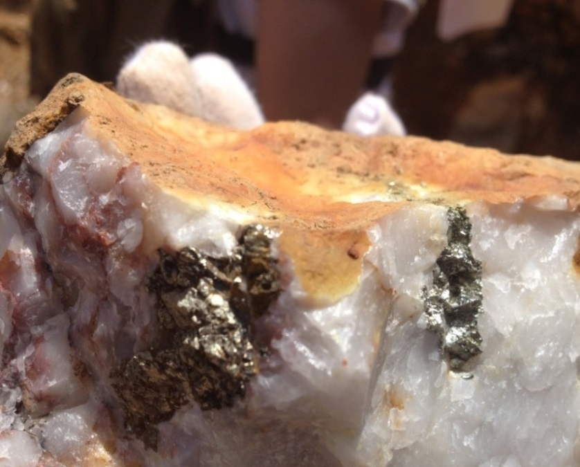
  • Primary type: Quartz veins containing auriferous pyrite and minor chalcopyrite — present in the Golden Goose workings.
  • Secondary type: Stratabound mineralisation in altered quartz-muscovite-kaolinite schist, graphitic schist or sericitic schist.
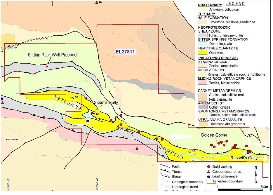
  • 40 gold mineralisation zones and quartz veins confirmed, distributed across four gold-bearing belts: A, B, C and N.
  • Ore bearing horizon is a set of low-to-medium high-grade metamorphic rock series in Paleoproterozoic.
Delineated Reserves

After several systematic exploration campaigns of the Winnecke Goldfield by authoritative institutions including the Hebei Bureau of Geology and Mineral Resources of China, the calculated gold reserves are significant:

  • Gold reserves within 40m shallow layer: 16.218 tonnes at average grade of 11.45 g/t
  • Within 20m layer: 4.38t Au at average grade of 0.86 g/t (403,162t ore)
  • Layer 20–40m depth: 11.84t Au at average grade of 11.68 g/t (1,013,809t ore)
  • Prospective inferred reserves: If gold grade remains consistent to 240m depth, prospective reserves may reach 64 tonnes
  • Historical surface mining produced approximately 2,000 kg of gold from shallow layers in the early 20th century

Drilling Exploration Programme

32 gold-bearing quartz veins have been identified in the Winnecke Goldfield. The drilling programme focuses initially on the Golden Goose area (~2.5 km²), which is the primary target for high-grade gold, including target zones A1, A2, and A3.

  • Stage 1: 120 boreholes planned to confirm proved reserves
  • Subsequent drillings will cover target areas B, C, D, E, and N
  • Following reserve confirmation: Mining feasibility study and ore processing plant scheme
  • Target: obtain mining licence and commence production

Fault Structures & Gold Occurrences

Ore Body Characteristics

40 gold mineralisation alteration fracture zones and quartz veins confirmed via geological mapping and on-site trenching. Ore veins distributed across four gold-bearing mineralisation belt areas: A, B, C and N.

Previous drilling limited to shallow depths (<40m). Further drilling required to identify and measure full gold reserve potential at depth.

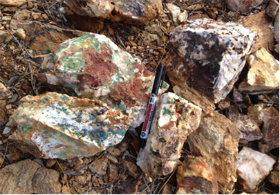
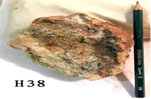
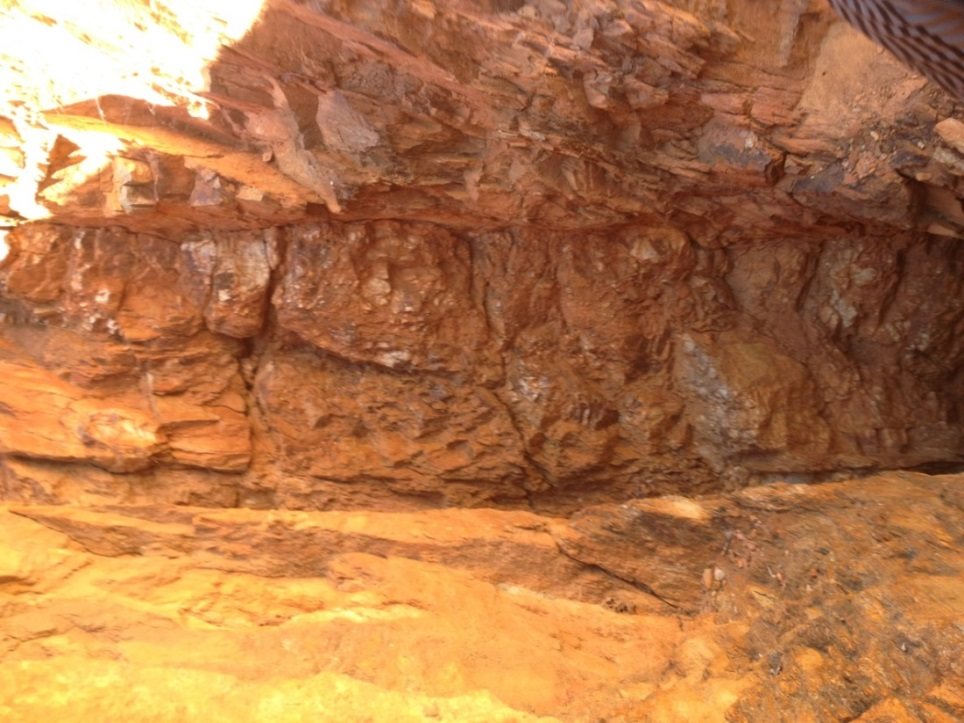
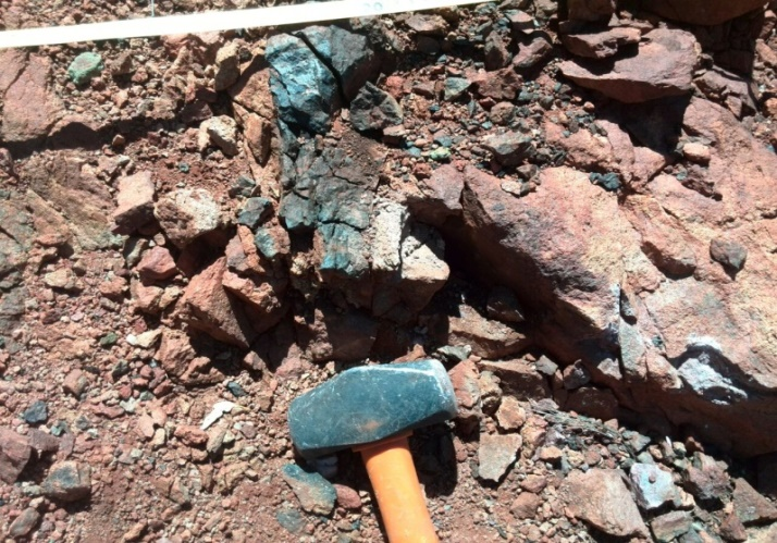
Field Photography — Winnecke Goldfield

Exploration Licence EL27942

Copper & Molybdenum

Jervois–Dulcie Copper Project

672,700t
Inferred Copper Metal Resource
1.86%
Average Copper Grade (Cu)
52 km²
Tenement Area
11 km
Main Vein Strike Length

Location & Setting

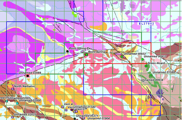
AMI's Exploration Licence EL27942 is located approximately 250 km northeast of Alice Springs in the Northern Territory, within the greater Jervois Mineral Field — part of the emerging polymetallic province of the eastern Arunta Region.

The tenement covers 52 km². Main resources include copper and molybdenum, with associated gold, silver, lead, and zinc mineralisation.

Geological Settings & Mineralisation

The project lies within the eastern Arunta Region where copper, gold, silver, and base metals were discovered, geologically related to:

  • Metamorphosed sediment and/or volcanic-hosted massive sulphide deposits associated with bimodal magmatism at ca 1.8 Ga (Jervois copper discoveries)
  • Mineral deposits related to mid-crustal felsic magmatism at ca 1.7 Ga (Bonya Hills)

Copper Mineralisation

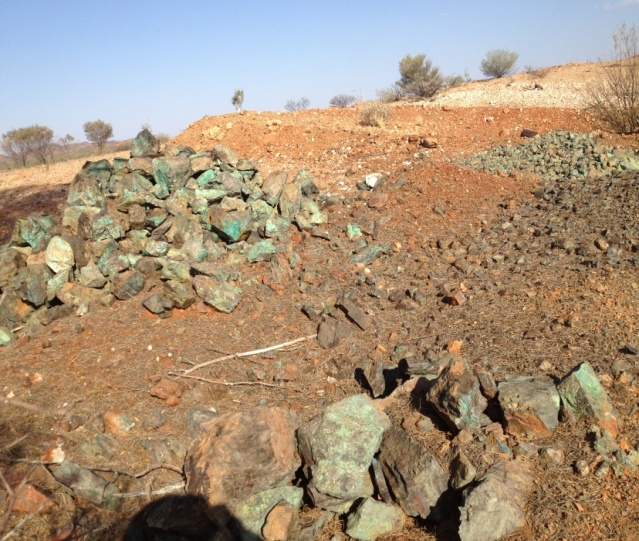
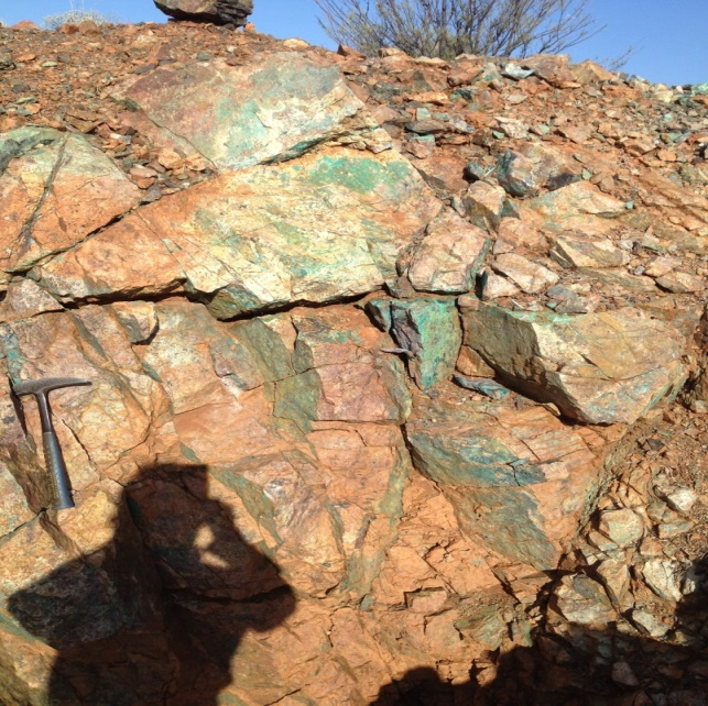
The copper mineralisation at Dulcie-Jervois comprises broad zones of disseminated malachite internal to the Proterozoic Jinka Granite margins. Mineralisation extends for several kilometers across the granite margin contact zone and into surrounding sediments.

Most known metalliferous deposits in the area are dominated by copper, molybdenum, and tungsten — a highly prospective polymetallic package.

Historical Estimates & Updated Resource

Freeman (1986) quoted an inferred resource of 3.66 Mt @ 2.8% Cu. Updated estimates in the 1990s reached 6.1 Mt @ 2.1% Cu. The newly updated indicated and inferred copper resource quoted by AMI's geologist teams from systematic geochemical analysis is 672,700 tonnes of copper metal, with the main vein extending 11 km at 1.86% Cu average grade.

Ore Body Analysis

Copper Ore Body & Reserves

Mineralised Body Characteristics

Through comprehensive geochemical survey, three ore bodies have been delineated, exposed near the contact zone between rock mass and surrounding rock bodies. They are controlled by Northwest-trending fault F1 and near east-west-trending fault F2.

  • Three mineralised vein belts stretching 11 km long, trending west-east
  • Average width: 80 metres
  • Intersection of the two fault structures and strong fracture zone represent the highest-grade zones
  • Ore bodies located along the geochemical anomaly and fault contact zone
  • Mineral outcrops clearly visible across all three ore bodies

Inferred Reserves Summary

The three ore bodies are connected as a whole with an east-west trending. Total mineralised body length: 11 km, average width: 80 m, average Cu grade: 1.86%.

Ore weight density: 2.74 g/cm³. Inclined depth: 50 m. Copper content in ore body calculated at 30%. Estimated prospective copper resources: 120.56 million tonnes of ore, yielding 672,700 tonnes of copper metal.

Deposit Classification

The Jervois-Dulcie copper mine is a large-scale copper deposit forming a key part of the famous Jervois copper-molybdenum ore belt in Australia. The primary copper deposit is classified as a porphyry copper deposit.

Geological engineering conditions, climate, terrain, and ore body characteristics are all suitable for open-cut mining — the preferred low-cost extraction method.

Copper Market Context

Copper is entering a sustained uptrend driven by Asian economic growth and global electrification demand. Goldman Sachs forecast copper prices averaging US$12,000 per tonne by 2024, up from US$8,325 per tonne previously.

AMI's high-grade Jervois-Dulcie copper deposit is strategically positioned to capitalise on this multi-decade commodity cycle driven by EV adoption, renewable energy infrastructure, and emerging market urbanisation.

Key Development Advantages

Open-cut suitability: Terrain, ore body orientation, and geological engineering conditions all favour low-cost open-cut extraction.

Scale: At 672,700 tonnes of copper metal, this qualifies as a large copper deposit by global standards.

Grade: 1.86% Cu average grade is above-average for a porphyry copper deposit.

Resource Estimate

Avg Width (m) Length (m) Inclined Depth (m) Density (g/cm³) Avg Grade (%) Ore Volume (000t) Metal Qty (t) Note
80 11,000 50 2.74 1.86 120,560 672,700 Mineral content calculated at 30%

Table 1: Estimate of Prospective Copper Deposit — Jervois-Dulcie Copper Belt (EL27942)

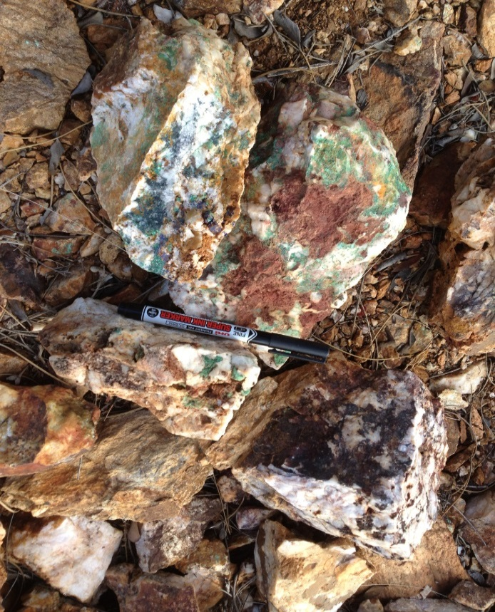
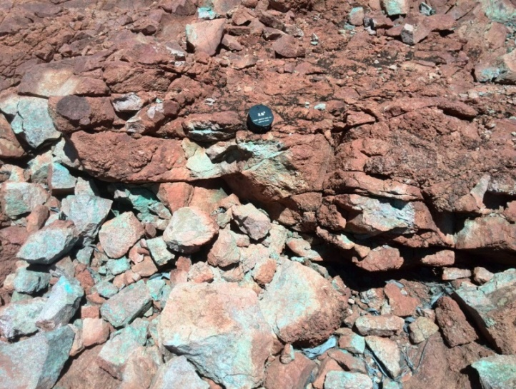
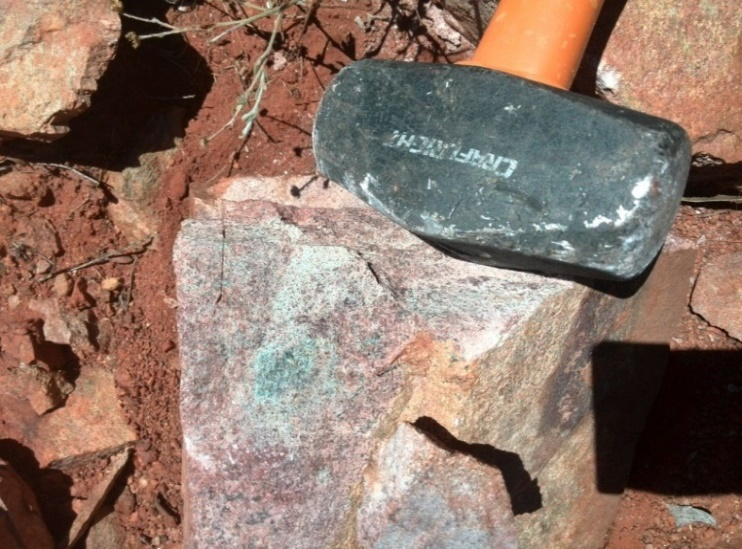
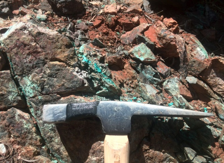
Field Photography — Jervois-Dulcie Project

Investment Opportunity

Learn About Our Company

Understand the mission, strategy, and competitive strengths that position AMI Resources to deliver superior returns for investors in Australia's gold and copper sector.